The hotel must have been really forgiving or had a very late check out time; I don't think, after a fill-up at a nearby gas station, that I got on the road until 12pm that day. I was also starting out with only a couple of granola bars for breakfast, and this was an very strange day food-wise.
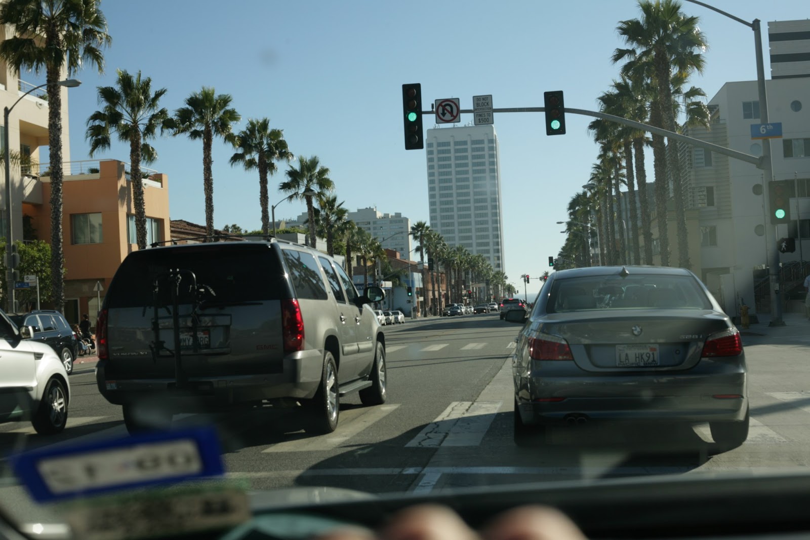
Doesn't this look like everybody's start to a day in LA? Bad thing was, this was noon on a random Sunday:

Entering LA city limits, the sign claimed a population a little over 4 million, or about 3 Dallases:


4 lanes of SoCal traffic, and I don't think it's the church crowd. Notice how slow California wants you to get to in order to exit the highway, God forbid they use access roads:

My first good look at downtown Los Angeles:

This is the tower right next to the Staples Center:

You'd think that I, being a big basketball fan, would have gone into downtown to visit Staples Center on this upcoming exit:

But, you'd be wrong! Downtown LA frankly didn't have very impressive surrounding roads and neighborhoods, and just didn't seem as put together as San Diego's CBD.
Nice wall of towers going by:

And I was running behind on schedule, so I went up the 101 northwest of downtown, and exited onto Melrose Ave.
There was so much traffic even turning left onto Melrose that it took me 3 or 4 light cycles to make that initial turn off the exit ramp. Driving in LA city proper is like this: the roads are nice and long and straight, but in this area near Hollywood, they're narrower, and there are a bazillion cars parked along the curbs.
Knowing those factors, it's not hard to imagine that it took a short while to drive the 5 miles from the 101 north exit to Urth Café, a coffee place native to LA. It was packed this Sunday afternoon with the lunch crowd. I had to sit at a tiny table amongst the diners to wait a couple minutes for my latte. This is the Pacific Design Center, which sounds classy:

After Urth (movie reference pun intended), I drove west on Santa Monica Boulevard, the dividing line between the neighborhood of Hollywood and the incorporated city of Beverly Hills. Cue the Weezer!

On the right side of the road is Beverly Hills, the actual 90210. On the left side, the plebians and riff raff of Hollywood and LA:


Yes, this is the famous shopping street called Rodeo Drive. My senior class and I walked along it in 2006, and the staff in the stores paid us high schoolers not dressed as Lindsay Lohan and the Jonas Brothers zero attention. Oh well:


That big collection of towers off to the left is Century City, one of the major movie production areas in LA:

I didn't plan on driving by the famous locations like the Kodak theatre and Sunset Blvd. area of Hollywood, I had my sights set on another famous road: Mulholland Drive. First I had to traverse a little bit of Interstate 405 north, between the LA basin and San Fernando Valley. It's one of LA's most feared and revered stretches of freeway, which is saying something there:


You'd think that since it's not surrounded on both sides by houses and apartments that there wouldn't be much local traffic to choke this highway up. You'd be right in a sense, but it's a major connector between the two aforementioned sections of the city. I've heard from a tour guide that the morning rush hour starts at 5am and can pick up at 2pm again, because a lot of people in the entertainment industry are on New York's Eastern time zone schedule, but living 3 hours behind in Pacific time. Therefore, that's the equivalent of 8am to 5pm Eastern time.
Mulholland Drive is named after a previous mayor of LA, and it winds west to east along the Santa Monica Mountains for miles and miles. Many movie stars and other celebrities have their multi-million dollar mansions on or near this route:


That may have been the overlook where I went over a curb that was too high for my car, and I heard a loud BANG! that made me wince in pain for my car. I looked at the next stop and there wasn't any real damage, but it sure sounded bad!
There are nice houses perched along the many ridges that fan out from Mulholland, and you can see pretty far over the valley from up there:


As you can see, there were some steep inclines between me and the houses below and in the distance:


I think this major north-south road is Van Nuys Blvd:


There were of course plenty of houses perched above the level of the road along the way:


Make no mistake, it's got corners along the drop-offs, it's a drivers' road:


Down below, near the eastern part of the Mulholland area, we see Universal Studios and surrounding shops, offices and even movie sets north of the 101:


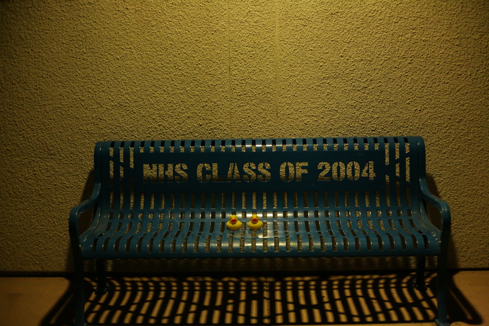
There was plenty of info for the Duckies to perch upon, staring out over Universal, where my senior class and I stayed and toured back in 2006, so very long ago:


As I drove further east, I finally got to look at the southern views of the canyon areas, with very distant views of Century City peaking into the upper left corner of this picture:

After maybe an hour on the drive, I reached the major easternmost overlook, and I'll show you the very famous view to the north first - the Hollywood Sign!


And voila! To the south, the quintessential views of downtown LA, the LA basin (entirely filled with city except for LAX airport) and Century City:


That major highway heading into downtown is the 101 again, and that's the Hollywood Bowl Amphitheater in the third picture. Despite the claims by urbanists and other naysayers that LA is too sprawling, it looks plenty dense from this overlook if you ask me. That area beyond the amphitheater is the Sunset Blvd. section of Hollywood. The tallest tower in the center of downtown is called the Library Tower, a little over 1,000 feet in height. Dodger Stadium is just north of the downtown loop of highways on its own hill, but unfortunately can't be seen from this distance. In addition to baseball, it's where Paul Walker first drives his lime green car super fast in the first Fast and Furious movie.
By this time, it was maybe 4pm, and I hadn't eaten anything substantial all day! Ugh. I wound my way down to the 101 from Mulholland, and made a big loop using that highway and 405 south to get to Santa Monica, and found Father's Office burger along Montana Blvd. and 11th Street. This was my only meal of the day, and it wasn't cheap, maybe $20 for the whole shebang. My Californian friend Cory Hollingsworth had claimed this was the best burger in LA, and I'm inclined to believe he's right based on this place. I met a Mavericks fan at the door who had just emigrated from Dallas and stated that he hated the Lakers, so I felt more at home there right away. I was wearing my Dirk #41 shirt so that's how that discussion got started :)
After devouring that burger, fries and coke deliciousness, it was time to return to Highway 1 at the Pacific Ocean and drive northwest along the coast into Malibu:


This was one of the sections of the trip, driving through Malibu, that conjures the most keenly nostalgic memories of this entire journey. The combination of the azure waves of the ocean on the left, road in front of the hood, dual layers of mountains on the right, and houses on the low cliffs along the road, with Snow Patrol's "The Planets Bend Between Us" made for a near heavenly experience!


Malibu extends for 25 miles along the southern edge of the Santa Monica mountains like this. The road gets very close to waters' edge here:


I'm not gonna lie, as I was passing the beaches in my car, I was half hoping to see Kevin Garnett running on the sand, arms spread out wide yelling "Anythang is possibuuuuuuuuuuuuuuulllllllll!!!!!"
**Laughter** Moving on...
Ok, so people tell me I'm a big movie person. They are proven most correct by this next couple of hours of August 26th, 2012. After I passed through Malibu, and the PCH took me a little inland through Oxnard and Ventura, instead of continuing along the coast for the rest of the day to San Luis Obispo (SLO to the locals), I turned north on a certain Highway 33 that ran up into the hills going away from the ocean.
About 15 miles inland, I came to a destination I was pretty excited to see: the little town of Ojai (pronounced "Oh Hi"). This is where the 2010 movie Easy A was filmed, featuring Emma Stone, Penn Badgley, Stanley Tucci, Phoebe from Friends and Thomas Haden Church. And Amanda Bynes before she went completely insane. And...Volchok from the OC! It's a modern take on the Scarlett Letter by Nathaniel Hawthorne, and Kathy Wilson and I find it funny and enjoyable. I obsessively looked up locations from the movie before I got there, which led me to the house where Emma Stone's character and family lived!

I'm not sure why some of the real family was in the above photo. I pulled up to the house, and the scary thing was that the dad was walking out toward my car, which I thought meant I wasn't supposed to be there. Turns out he thought I was the guy coming to pick up his daughter for a hangout, and I quickly corrected him by telling him I was just a fan of the movie and wanted to take some pictures. He was very accommodating after that, even taking a picture of me and the Duckies at the front door, with one of his big dogs watching closely:

The dad told me fun stories of how his young son had done all the negotiating with the movie production folks to work out a good financial deal for the crew to borrow the house for 3 weeks to film the movie, and he told me that his teenage son's claim to fame from this experience was that Emma Stone took a nap in his bed once! The house was chosen mostly for this side lawn where Penn rides up on a lawn mower playing the Breakfast Club theme song to drive away with Emma Stone, a la Lloyd Dobler from Say Anything:

The hardest location to find and get to on this side venture was this overlook, which is driven to in the movie, but closed to cars in real life. I hiked maybe 10-15 minutes each way, no too long before sunset, to get some shots of this small town, which has about 8,000 people:
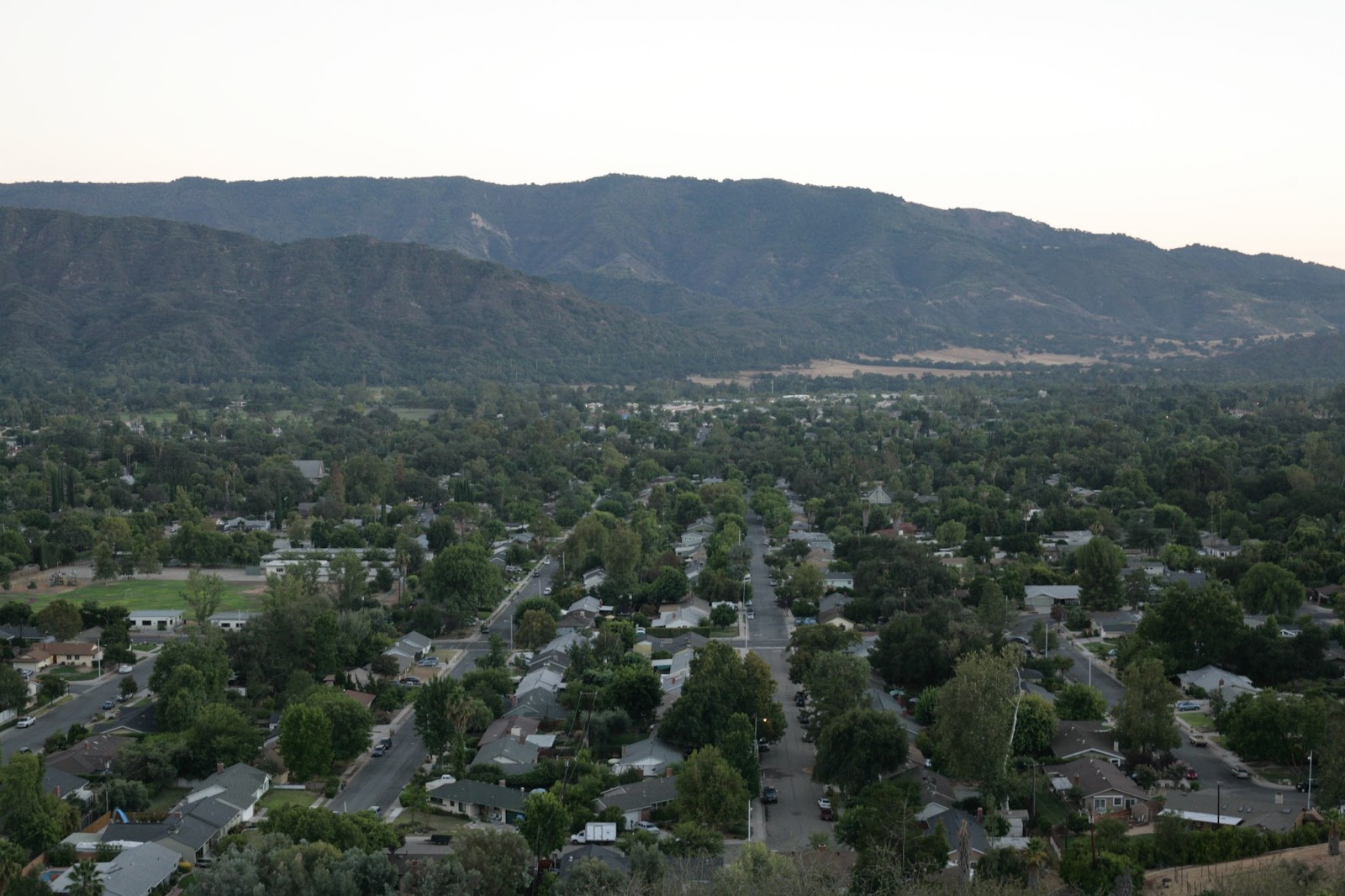


A few of those photos featured what Wikipedia calls a pink moment, at sunset. I was very blessed to have gotten to this elevated spot right at sunset, and the place was great for photos because the town is surrounded on all sides by mountains:

It felt a little odd to be walking 15 minutes back to my car in the fading twilight, I felt like I wasn't allowed to be walking along people's property, but it was fine. I pointed the camera upward to a purple sky and some orange groves along the way:

I got back to the car, rolled the windows down to enjoy the mild temperature, and found the bookstore where Emma Stone looks for a Bible nearby:


Next stop was Main Street. Ojai falls into the quaint and artsy category, a nice little town, very not-LA:


The last part of Ojai involved finding the local high school where most of the movie was filmed, and there I really did feel out of place:


That side venture into Ojai was a lot of fun, to get to visit such a specific place. When I looked at my Google maps on my phone at the gas station heading out of Ojai, I realized that instead of maybe an hour left of driving, I actually had about 3 hours of driving remaining, and it was 9pm, fully dark as you could see. I purchased another Starbucks doubleshot, filled up the tank, and started back toward the coast.
This last part of the day was pretty typical as the trip wore on: driving late at night, with only music instead of scenery to entertain me. Which is fine with me, it was too dark to see the beaches, ocean and mountains, so I just cruised on the PCH and Highway 101 until nearly midnight to reach Morro Bay, about 20 miles west of SLO. Morro Bay is on the west coast of California, but I couldn't see any of that at night. The one scare was that the night manager took a minute to come to the door when I knocked to get my key. It was late, and chilly in shorts, maybe 55 degrees with a breeze. He did show up, and I got to eat some more Special K bars and watch Friends on tv before konking out, still thankful for my second full day in California.
No comments:
Post a Comment