I'd been to Tahoe before with my parents in 2008, and had of course loved the mountain scenery. I liked my little hotel, surrounded by lots of pines and fresh air, which I checked out of around 11. I went to the local Starbucks to enjoy the nice weather, get a doubleshot and an apple fritter, and do some more reading about the road I was about to tackle. It's called U.S. Highway 50, and it's officially tagged as the Loneliest Road in America. I found out about it in a Top Gear UK episode where the boys take a road trip from San Francisco to...Bonneville. If I were British, after this part of the journey, I'd say "I see what they're on about!"
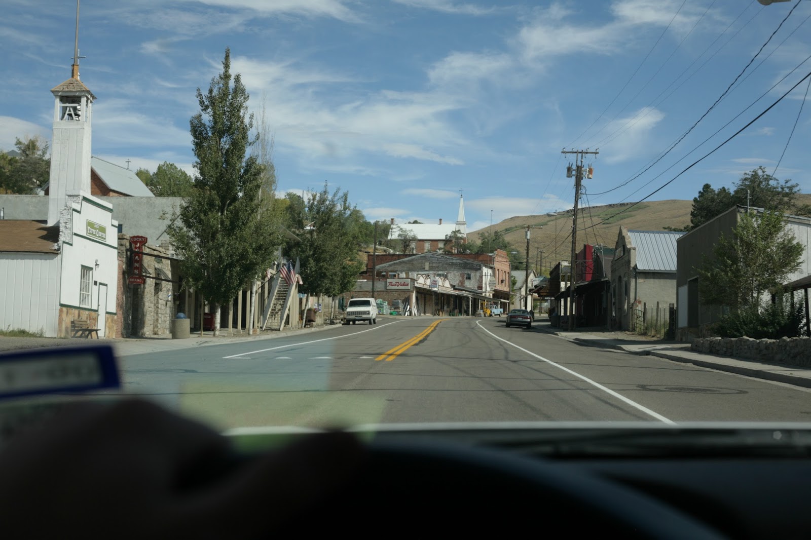
First, the view down Main St. in South Lake Tahoe, near the state line:

For some reason, I forgot to take back a Redbox movie I'd rented the night before, so I had that with me all the way to Utah. Good job Matt.
Ok, I set off around noon, going east on US 50 over the state line, past the casinos on the Nevada side, and caught some brief, oh so brief, glimpses of the smooth surface of Lake Tahoe through the pines:


And I popped out on the other side, the eastern slopes of the mountains near Tahoe, as US 50 heads downward toward Carson City, NV. It was fun to keep the car in 3rd or 4th gear and coast down toward the desert city, with a long sightline along the way:


Carson City isn't too big, so I drove straight to the center of town to fill up the tank with gas, for I would need every drop today.
Here's the problem that arose though: I had been absolutely chomping at the bit to start driving fast immediately. I mean, it's the Loneliest Road in America, why couldn't I just take off like a bullet across Nevada? Well...the speed limits on US 50 are conservative all the way from Carson City to Fallon, which is 62 miles to the northeast. I'm already not a patient person, and I couldn't justify breaking maybe 55 mph through these rural areas that still had some civilization along the way. Cops could be hiding behind some buildings or other cars, since there were a decent number of vehicles driving on this wide, 4-lane "highway" which was just a big avenue crawling toward Fallon.
Once I got to Fallon, I was starving, so I loaded up on a double patty burger and tots from the local Sonic (which had been lacking in Morro Bay, CA when I needed it late at night!), and then things opened up, and I saw why the highway had gotten its name in 1986:


Ooooohhhhh man! I set the cruise control up in the 80s, with no worries, and began tearing down the highway toward Austin (not Texas). Why no worries all of a sudden? The wide open visibility lends itself to being able to see every vehicle for many, many miles up and down the road. Exhibit A:


I started to make a game out of seeing how fast I could get between towns in Nevada; I felt like the normal expected travel times could be steamlined and improved upon on this empty road. 111 miles certainly took less than 1.5 hours to reach Austin:
Austin is a very small town, so I had to slow down from 80+ to 25 mph, and wind my way up some hills and back onto the flatlands.
In the next two pictures, you can clearly see why I felt justified in passing the rare truck I did come across at 100mph, and sometimes well over that speed mark. In fact, on the fastest occasion, I managed, uh, 191 feet per second (in case the US Government is reading this):


Crazy thing was, as I was zooming along at 191fps, I saw a truck in the distance that, at the beginning of the speed blast, looked like it was maybe 5 miles away. I was going extra fast for a good minute or two, and by the end of that span, the truck was no closer than it had appeared before. I caught up to it 10 minutes later, and it was a Tahoe that was going about 70 mph. In other words, the perceived distances were greatly distorted out there in the wild wild West.
Now, back to how I was loving driving fast, listening to INXS really loud, and then revisiting the comedy of my high school years: Dane Cook's Retaliation album. I was racing the 147 miles from Austin to Ely, which would put me in Ely right around dinnertime. I got a lot of quality thinking done on that sunny Wednesday, aided by the scene of the mountains of the Toiyabe range in the distance:

Another interesting fact - because Ely is in the Great Basin and sits over 6,000 feet above sea level in the nation's driest state, it is listed as one of the coldest places in the continental US. The town experiences extreme day-night temperature swings, and thus averages 218 days a year with a low temperature below freezing. Thank God I didn't have to experience that!
I stopped for some gas and snacks first, and then drove down Main street to All American Pizzeria, where I sat down amongst Italian decorations and dove into the buffet to satisfy the big appetite I'd built up that afternoon. Mmmm...
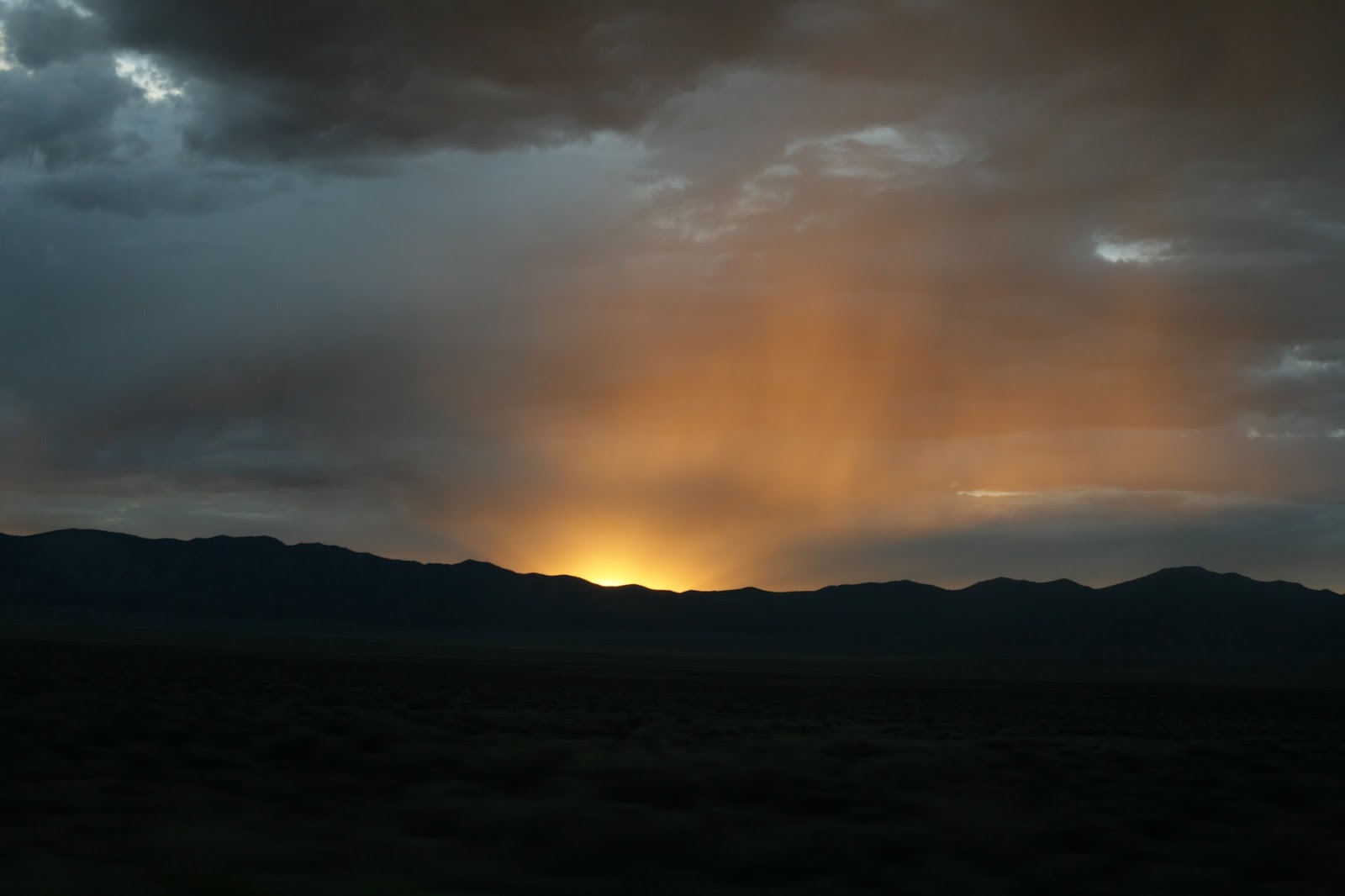
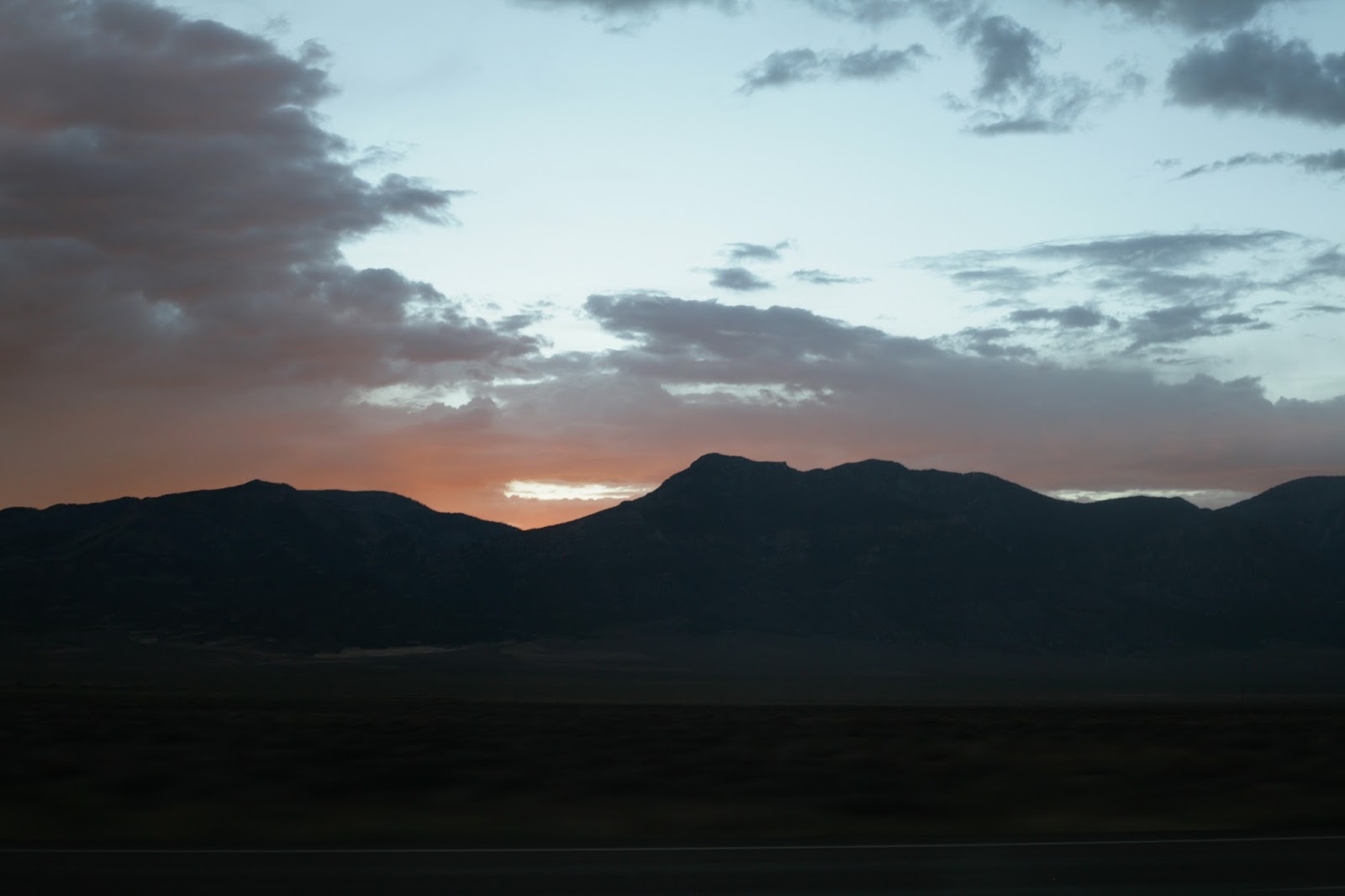
A final note on how this all relates to the Top Gear episode - I'd feverishly looked on Google maps for the winding road that the presenters described as "incredible" in the mountains east of Ely that took them off the long, straight highway to I-80 and Bonneville in Utah. Try as I might, I couldn't find the road before I'd left Tahoe that day. This frustrated me, and it was already getting dark by the time I pulled out of Ely, so I relented on the other road and turned north on Highway 93 heading to Wendover, Utah. It also looked stormy above the mountains on either side of the road as I began the rest of the evening drive:


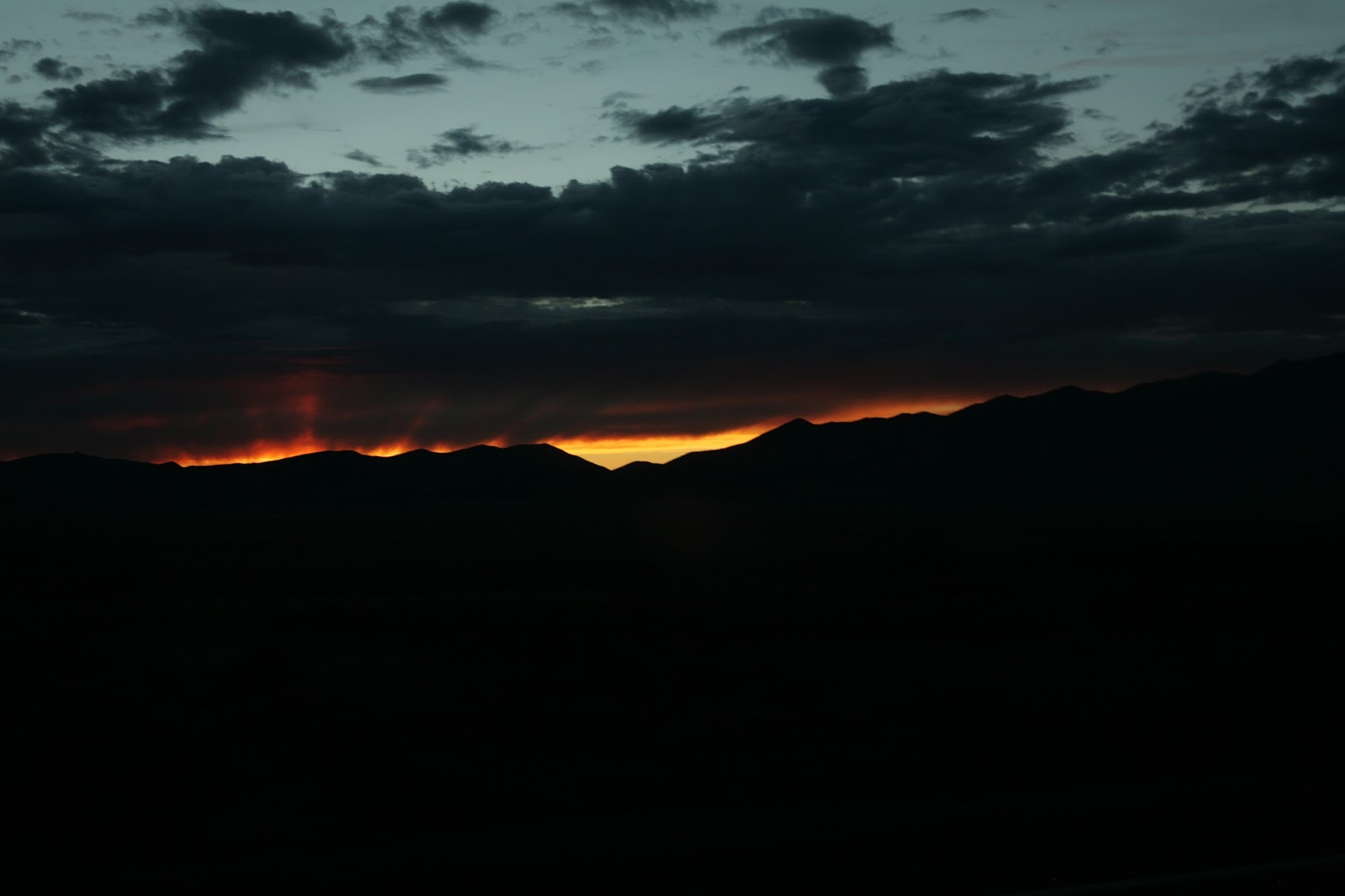
But then, a light appeared at the end of the cloudy tunnel...


And then a light, a bright light shone forth over the mountains:


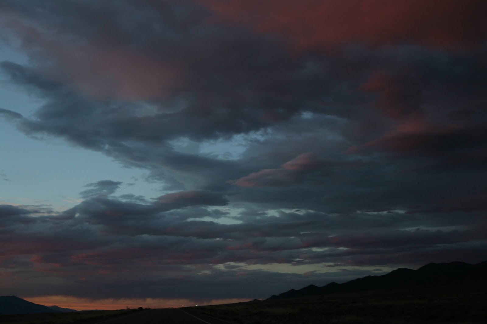
Wow...check this out: on the west side and above me, the sky was like a curtain of fire:


Then the sky turned from orange toward pink and red, and the spectacle got even more grand, for miles on end:


If you're thinking that the pink clouds look like Martian dust, I totally agree with you. But wait, it gets still better...